21 Types of Navigation Equipment onboard Ships in Maritime
Thanks to modern facilities and automation, the vessel is equipped with several advanced navigation equipment systems that provide accurate voyage data. Here are 21 different types of navigation equipment that are available on all merchant ships
Modern sailors are trained to know how all modern navigation equipment works, which has made sailing at sea smoother and safer.
Thanks to modern facilities and automation, the vessel today is equipped with several advanced navigation equipment systems that provide accurate voyage data.
In this article we would like to present 21 different types of navigation equipment, both old and new, that are available on all merchant ships nowadays.
1 Gyro Compass
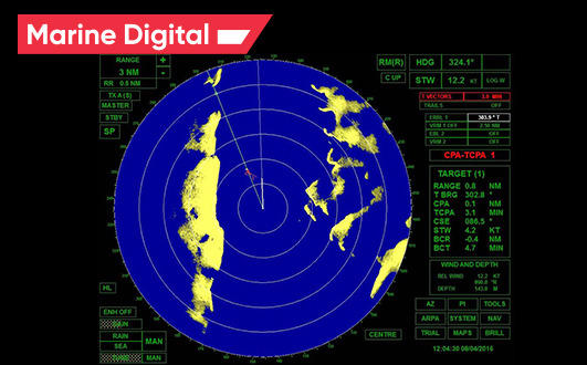
Marine vessels rely on an S-band and X-band radar system for navigation as it can detect targets and display information on the screen such as the ship's distance from the ground, any floating objects (island, rocks, iceberg, etc.) ), other vessels and obstacles to avoid collision. It is a rotating antenna that detects the surrounding area of the ship.
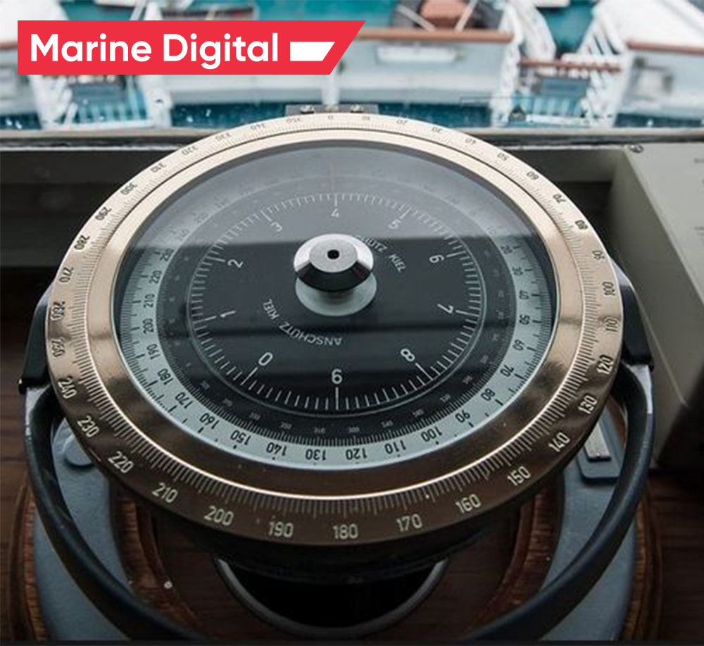
It is used to find the right direction. Unlike a magnetic compass, the gyrocompass is not interfered with by an external magnetic field. It is used to determine the correct north position, which is also the Earth's axis of rotation to provide a stable directional source. Its repeater system must be installed on the steering platform for emergency steering.
2 Radar
3 Magnetic Compass
The bridge plan is filled with equipment and instruments used for navigation. Autopilot is considered one of the most effective bridge navigation aids as it helps the human operator steer the vessel by holding the steering in autopilot mode, allowing them to focus on the broad aspects of the operation. It is a combination of hydraulic, mechanical and electrical systems and is used to control the ship's steering system from a remote location (navigational bridge).
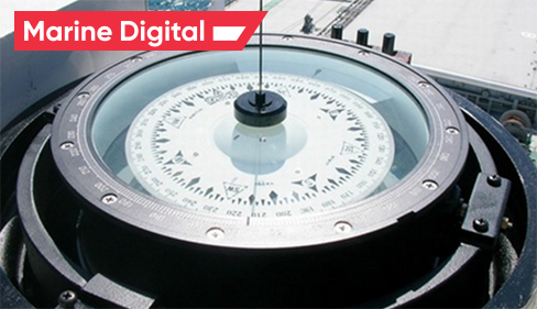
The magnetic compass works in conjunction with the earth's magnetic field and is the primary means of the direction indicator. It is used to obtain the planned voyage route. This ship's navigation equipment is usually installed on the centerline of the ship on Monkey Island. The magnetic type transmitting compass is mounted so that the output signal can be displayed on the bridge panel.
4 Autopilot
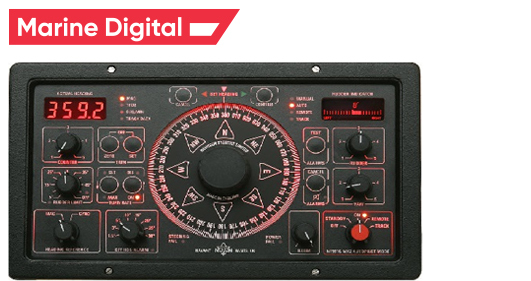
An automatic radar plotting aid displays the location of the ship and other vessels nearby. The radar displays the location of nearby ships and selects a course for the ship, avoiding any type of collision.
This navigation equipment on the bridge constantly monitors the environment of the ship and in this case automatically determines the number of targets; ships, boats, stationary or floating objects, etc., and plot their speed and course accordingly. It also presents them as vectors on the display screen and constantly updates the parameters with each rotation of the antenna, calculating their closest points of approach to their own ship, as well as the time before this happens.
This navigation equipment on the bridge constantly monitors the environment of the ship and in this case automatically determines the number of targets; ships, boats, stationary or floating objects, etc., and plot their speed and course accordingly. It also presents them as vectors on the display screen and constantly updates the parameters with each rotation of the antenna, calculating their closest points of approach to their own ship, as well as the time before this happens.
5 ARPA
6 Automatic Tracking Aid
This bridge equipment on a ship is used to measure the speed and distance the ship has traveled from a given point. With the same calculation, the ship's ETA is adjusted or transmitted to the port authority and agent.
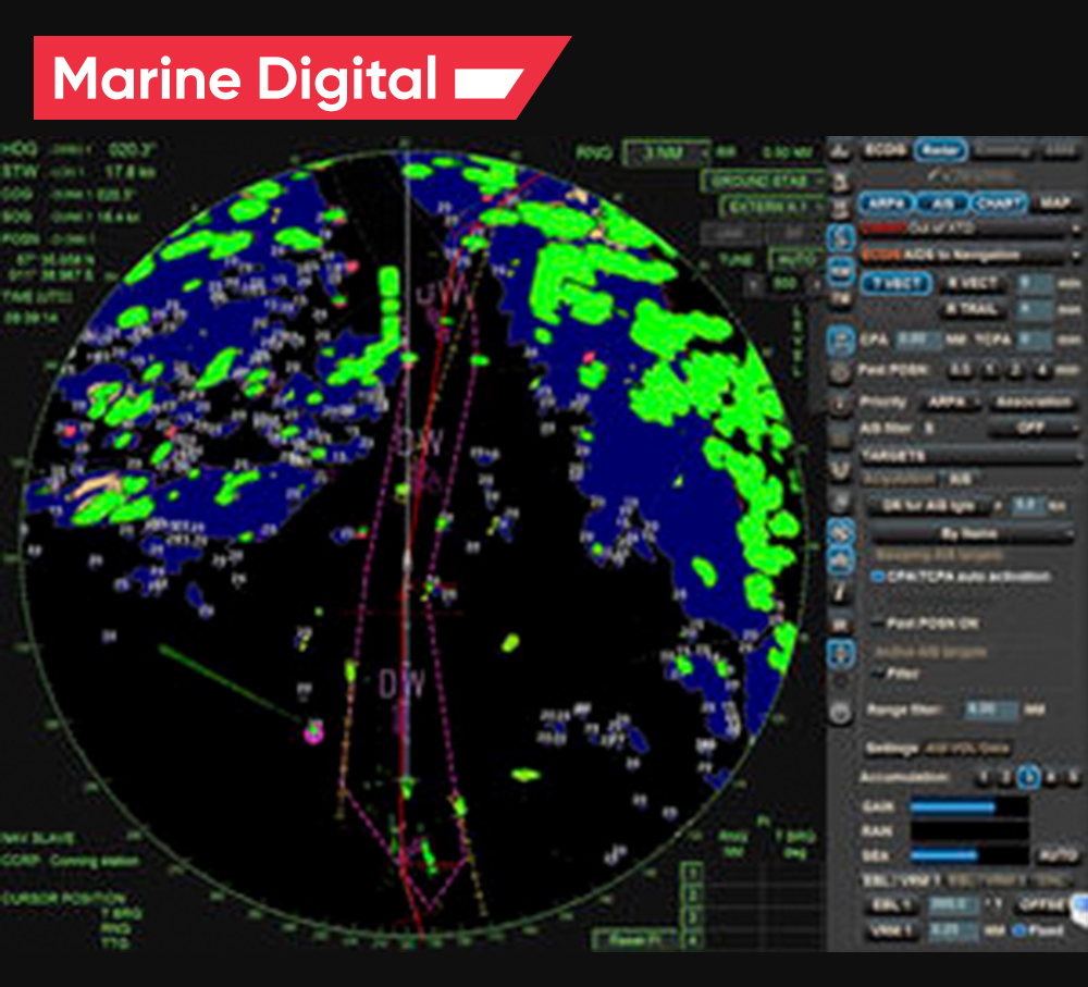
As with ARPA, the automatic tracking system displays information about tracked targets in graphical and numerical form to create a planned plan for a safer course without collisions.
Typically, a large target with a circumference of 800 m or more is considered land and is not tracked. Echoes less than 800 m away are considered targets to be tracked.
Typically, a large target with a circumference of 800 m or more is considered land and is not tracked. Echoes less than 800 m away are considered targets to be tracked.
7 Speed & Distance Log Device
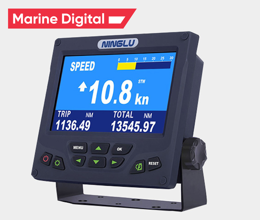
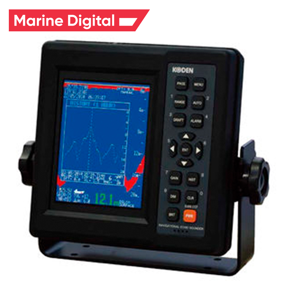
There are many modern shipborne navigation instruments on board and the echo sounder is one instrument that has been in use for nearly 100 years. It is used to measure the depth of water below the bottom of a ship using sound waves, which work on the principle of sound wave transmission, and a sound pulse that bounces off a reflective layer and returns as an echo to the source.
8 Echo Sounder
9 Electronic Chart Display Information System (ECDIS)
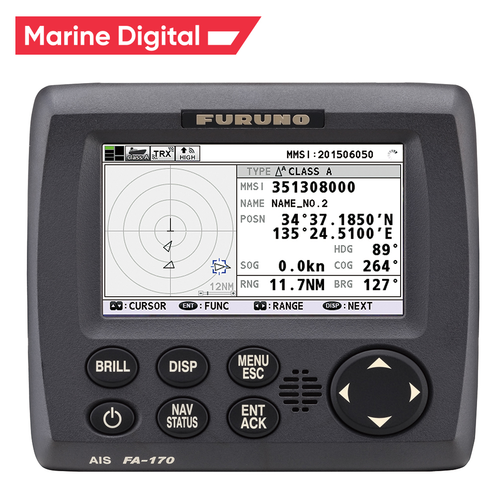
AIS is also among the types of navigation systems that help to accurately determine the position and other navigation statistics of ships. AIS uses VHF radio channels as transmitters and receivers to send and receive messages between ships, allowing for a variety of tasks.
In accordance with the rules of the International Maritime Organization (IMO), all passenger and commercial ships of over 299 gross tonnage sailing in international traffic must carry an AIS class A transponder.
In accordance with the rules of the International Maritime Organization (IMO), all passenger and commercial ships of over 299 gross tonnage sailing in international traffic must carry an AIS class A transponder.
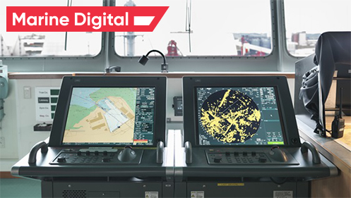
ECDIS is a development of a navigation chart system used on ships. Thanks to the use of electronic navigation equipment, it became easier for the ship's crew to determine the location, and it became easier to navigate than before.
10 Automatic Identification system (AIS)
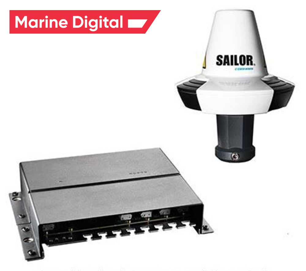
LRIT is an international tracking and identification system incorporated by IMO in accordance with its SOLAS convention to provide a thorough tracking system for ships of 300 gross tonnage and above that make international voyages around the world. This marine equipment is designed to raise awareness of the marine field.
11 Long Range Tracking and Identification (LRIT) System
12 Rudder Angle Indicator
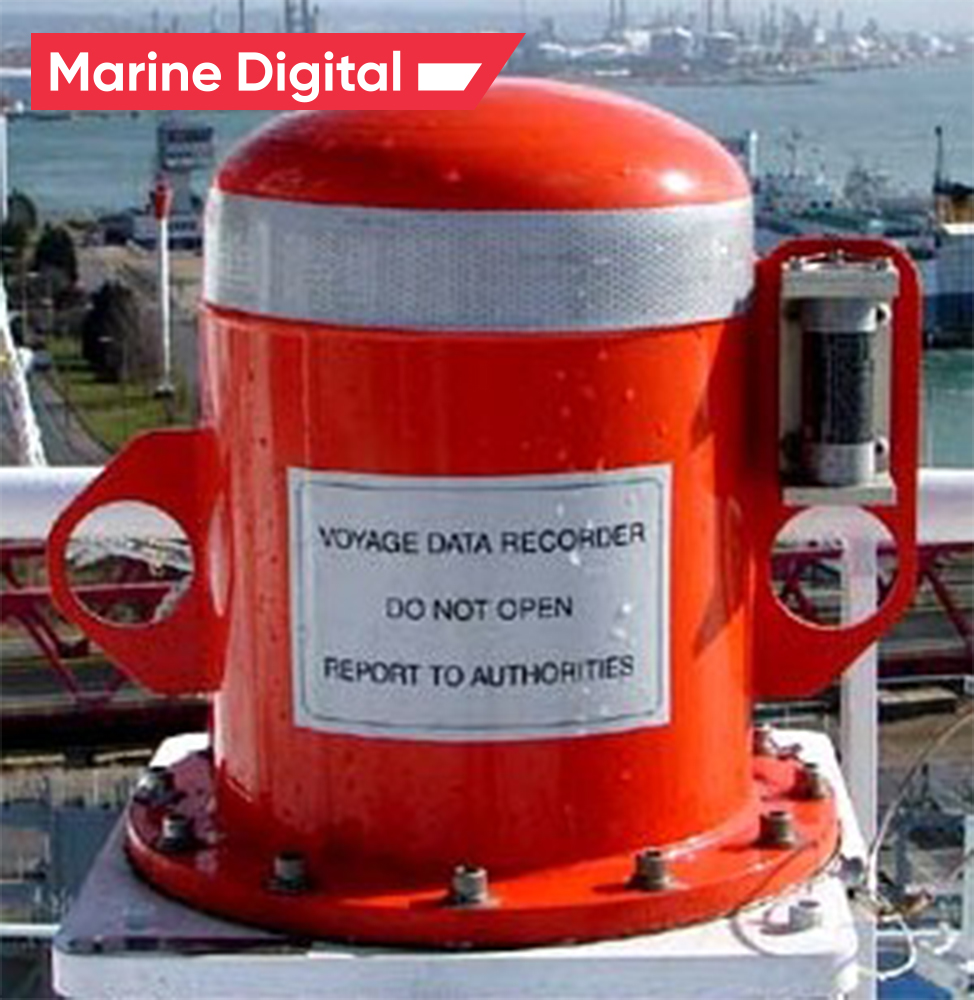
The VDR is an essential tool in the list of shipborne navigation equipment that is installed on a ship to continuously record important information related to the operation of the ship. It contains a voice recording system for at least the last 12 hours. This record is restored and used for incident investigation. The importance of the VDR is like a black box mounted on an airplane.
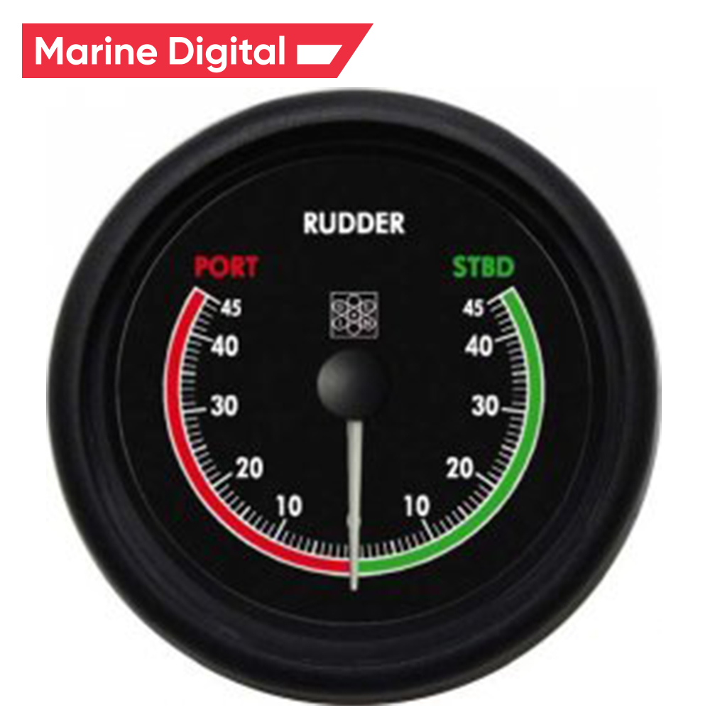
The rudder angle indicator, as the name suggests, shows the steering angle. The display is located on the bridge equipment console, so the ship's navigator can control the steering speed and rudder angle. The indication is also provided in the bridge wing and in the engine control room.
13 Voyage Data Recorder (VDR)
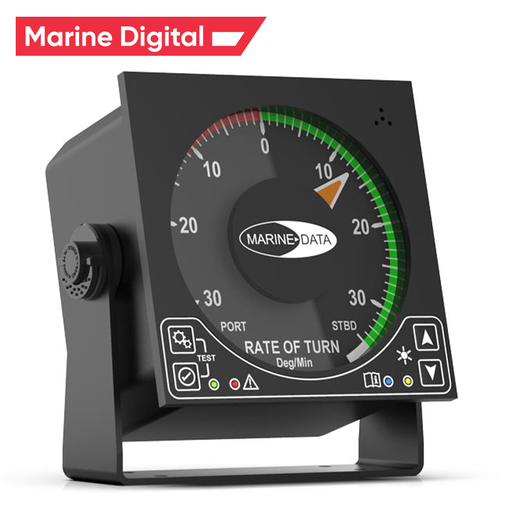
This navigation tool shows how fast the vessel is turning at a constant speed (useful during pilotage and maneuvering), usually displayed as a number of degrees of turn. The ship's turn rate is measured in degrees per minute. This important tool helps the helmsman to steer the course safely.
14 Rate of turn indicator
15 GPS Receiver
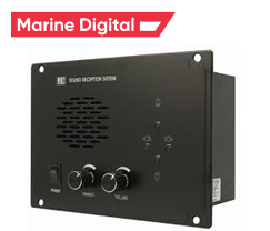
This speaker system is essential for a ship with a fully enclosed bridge. This allows the navigator inside the cabin to hear audible signals (such as fog or a ship's horn) from other ships in the vicinity. It is installed in the console of the ship's equipment on the bridge and helps the navigator to perform watch in accordance with the International Rules for Preventing Collisions at Sea.
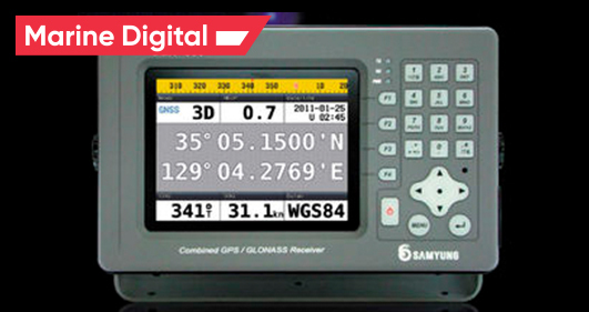
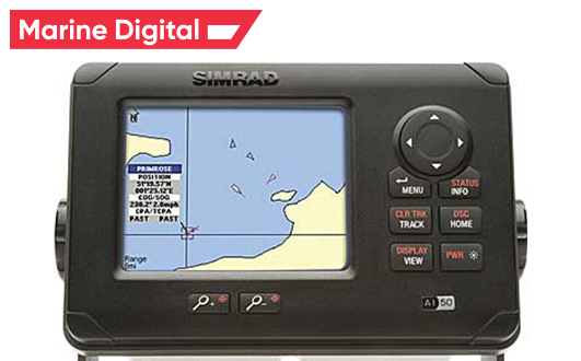
A global positioning system (GPS) receiver is a display system used to display the location of a ship using a global positioning satellite in earth orbit.
By recording the ship's position, you can calculate the speed, course and time required to cover the distance between the "two marked positions".
By recording the ship's position, you can calculate the speed, course and time required to cover the distance between the "two marked positions".
16 Sound Reception System
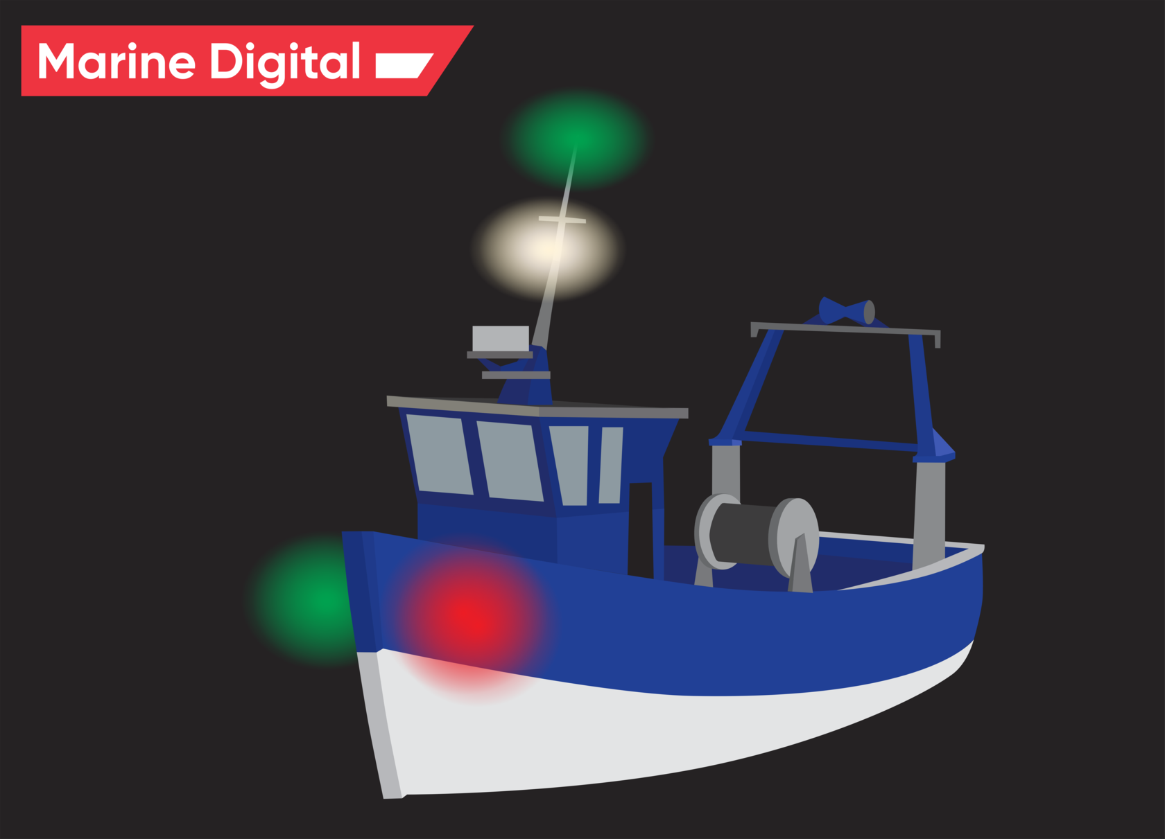
All boats - large or small - must have night lights as part of their navigation systems. This system was introduced in 1838 by the United States and then followed by the United Kingdom in 1849. In 1889, the United States established the International Maritime Conference to establish appropriate guidelines for the prevention of maritime accidents. In 1897, these rules were officially adopted internationally. Navigation lights are one of the most important navigational devices required for sailing on the high seas, as they allow you to see your own ship clearly to other nearby ships.
17 Navigation Lights
18 Daylight Signalling Lamp
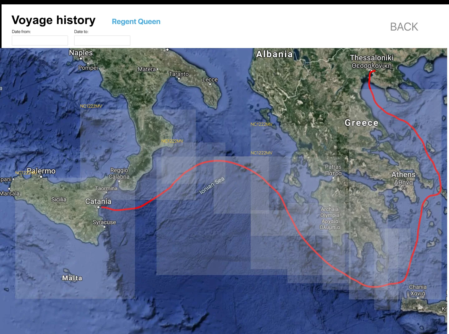
Marine Digital route planner based on geo, storm and weather conditions. It lays the optimal route not only along the shortest route, but also uses data on the storm, geo, currents, waves and other weather conditions to calculate the safest and most economical route for the ship to the port of destination. Read more Optimizing your vessel's route for time and fuel consumption.
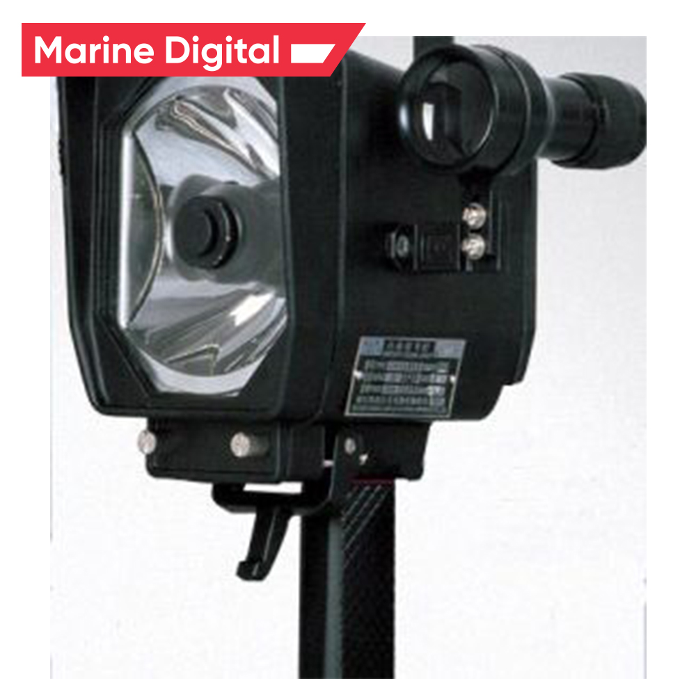
These are light signaling devices used for daytime alarms (and can also be used at night). Like other marine emergency appliances, the power source for the lamp does not depend solely on the ship's main power source. In addition, the lamp housing must be made of a material that is resistant to weather and seawater.
19 Voyage/Route Planner
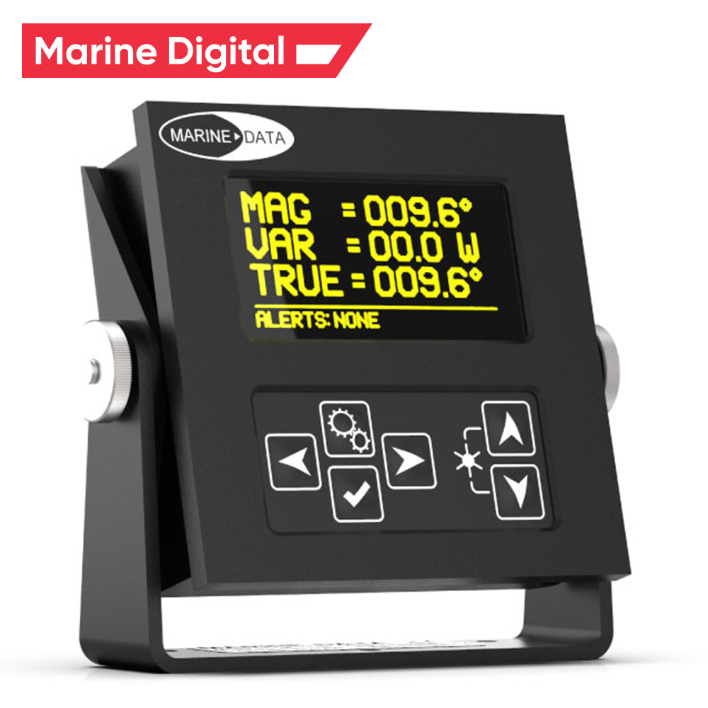
THD is an electronic device that is used to display information about the ship's true heading. For THD compliance information see chapter V of SOLAS.
20 Transmitting Heading Device (THD)
21 Ship Flags
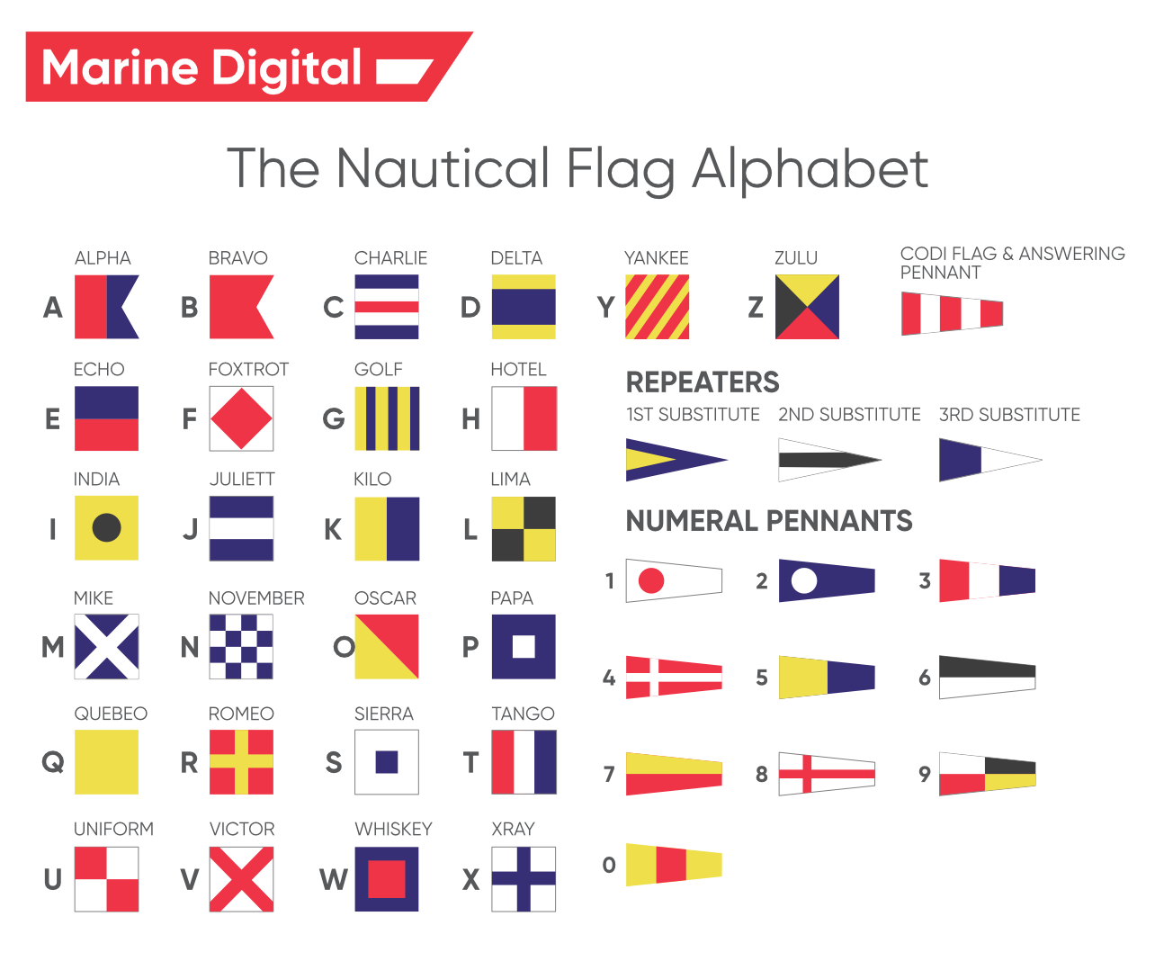
Various types of flags with different colors and marks are used to indicate the position of a navigational vessel. Signal flags - they are widely known, have been used since ancient times and are still used on all ships today.
In Marine Digital we during the development process have formed 4 solutions that are suitable for charters, shipowners and fleet managers of different types of vessels for:
Read also about Cybersecurity of AIS, ECDIS, VDR, EPIRB and other specific information systems for shipping companies and technologies in the maritime Industry.

TOP 5 factors contributing to lower fuel costs for Shipping companies
Get a presentation with a full description of the features and free pilot project with trial of Marine Digital FOS for 2 months
"Clicking the button, you consent to the processing of personal data and agree to the privacy policy"

Get an overview "The Pathway to Zero Carbon Shipping:
IMO Compliance and CII Optimization through SEEMP" on email and download it for FREE! Leave your email now!
"Clicking the button, you consent to the processing of personal data and agree to the privacy policy, as well as consent to subscribe to the newsletter. "
Аdvantage of Fuel Optimization System from Marine Digital:

Marine Digital FOS can be integrated with other system and third-party's solutions through the API. To implement vessel performance monitoring for any vessel, we are using mathematical algorithms, machine learning and the same equipment as in FOS. The more data we collect from vessels, the more precise reports and recommendations our system will perform according to your individual requirements in fleet management.
If you have any questions about the solutions and the Marine Digital System platform, write to us, we will be happy to answer
If you have any questions about the solutions and the Marine Digital System platform, write to us, we will be happy to answer

Increased business process speed

Reducing to zero the number of errors

Best offer to the clients

Reduction in operating expenses
Have a questions?


